
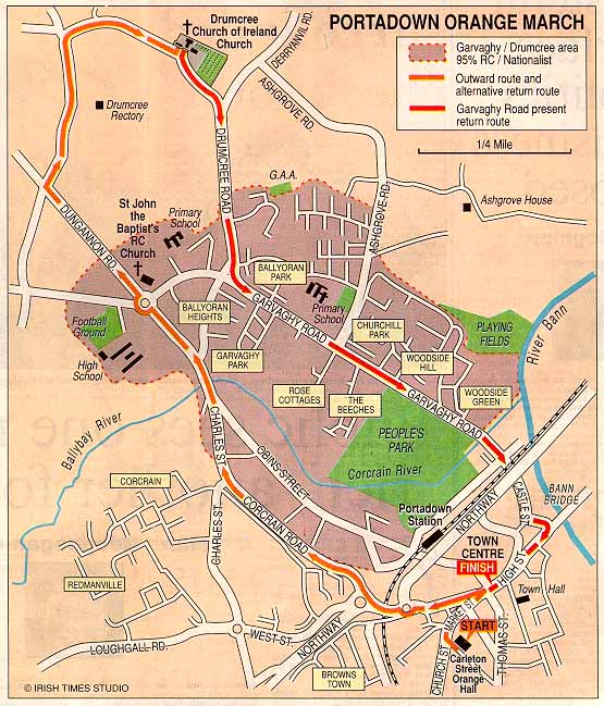
Map of the Garvaghy Road Area of Portadown[Key_Events] Key_Issues] [Conflict_Background] BACKGROUND: [Acronyms] [Glossary] [NI Society] [Articles] [Chronologies] [Organisations] [CAIN_Bibliography] [Other_Bibliographies] [Research] [Photographs] [Symbols] [Murals] [Posters] [Maps] [Internet] Material is added to this site on a regular basis - information on this page may change
Map of the Garvaghy Road Area of PortadownThis map was originally published by the Irish Times on Saturday 5 July 1997.
|
CAIN
contains information and source material on the conflict
and politics in Northern Ireland. CAIN is based within Ulster University. |
|
|||
|
Last modified :
|
||
|
| ||