Visualising the Conflict
Geographic Information Systems (GIS) Maps
Map Set 1: Outline Maps
Maps drawn by Luke Kelleher; text by Martin Melaugh |
| Map Set 1: Outline Maps - Introduction |
Maps - Outline Maps, by area, of Ward Boundaries (1995) (8 maps)
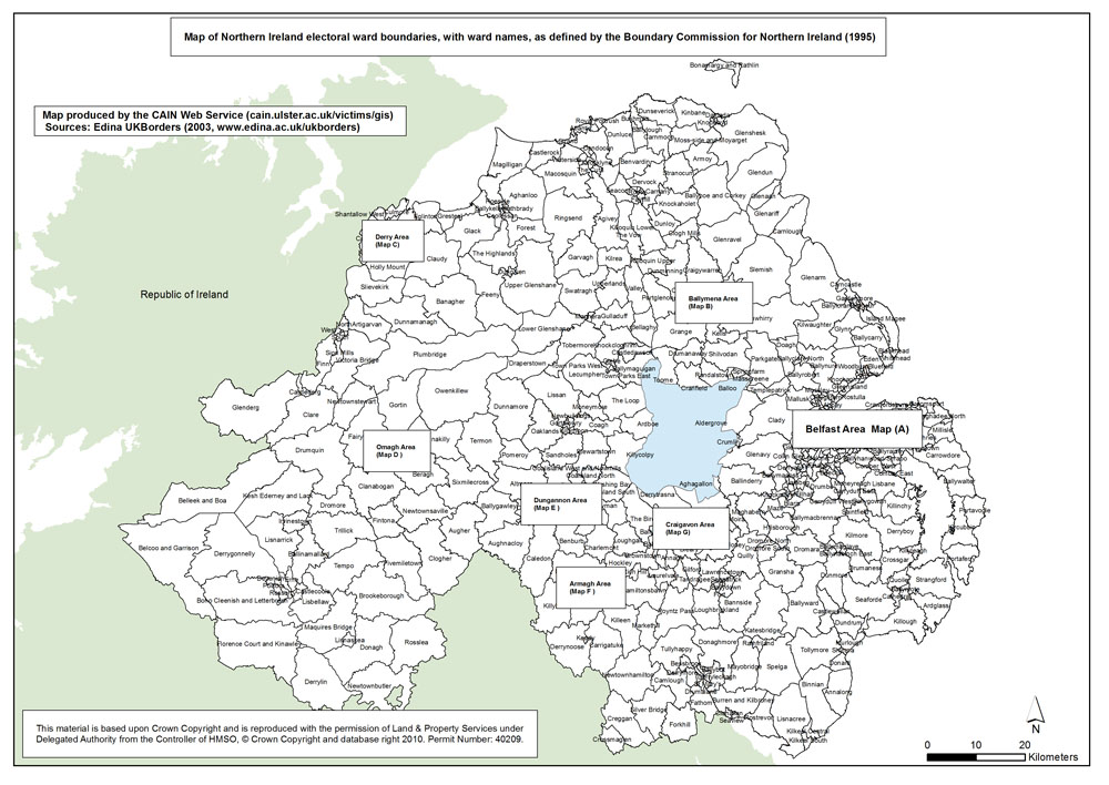
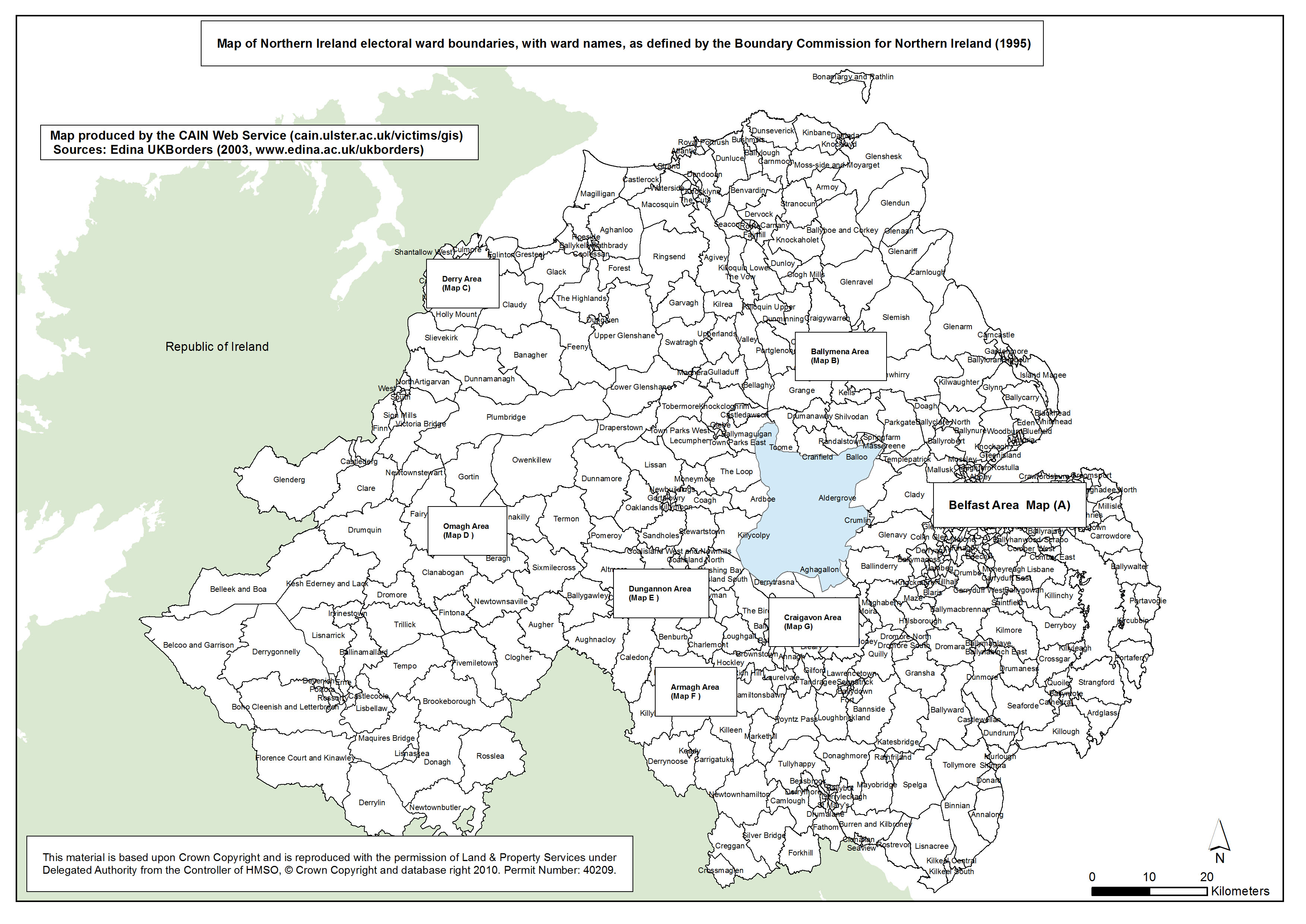
 This set of maps provides the electoral ward boundaries and names, as defined by the Boundary Commission for Northern Ireland in 1995. In total there were 582 electoral wards in Northern Ireland. In addition to a map of Northern Ireland, seven more detailed urban area maps are included: This set of maps provides the electoral ward boundaries and names, as defined by the Boundary Commission for Northern Ireland in 1995. In total there were 582 electoral wards in Northern Ireland. In addition to a map of Northern Ireland, seven more detailed urban area maps are included:
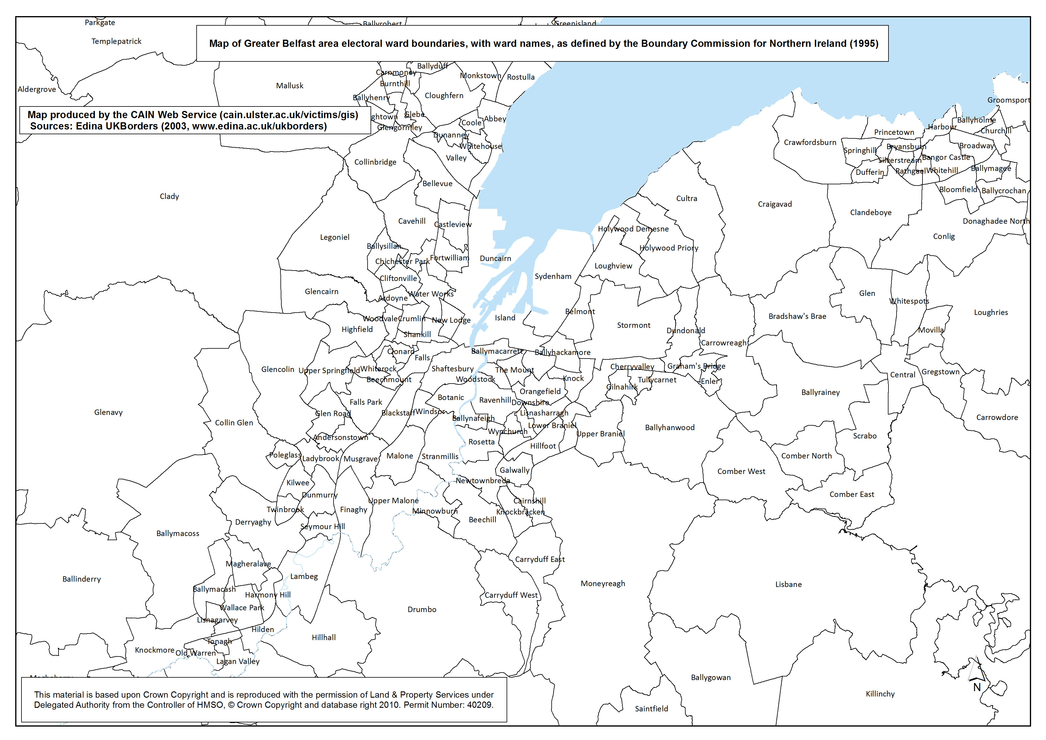
- Map A. Greater Belfast area;
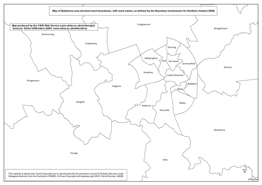
- Map B. Ballymena area;
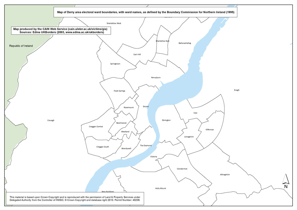
- Map C. Derry area;
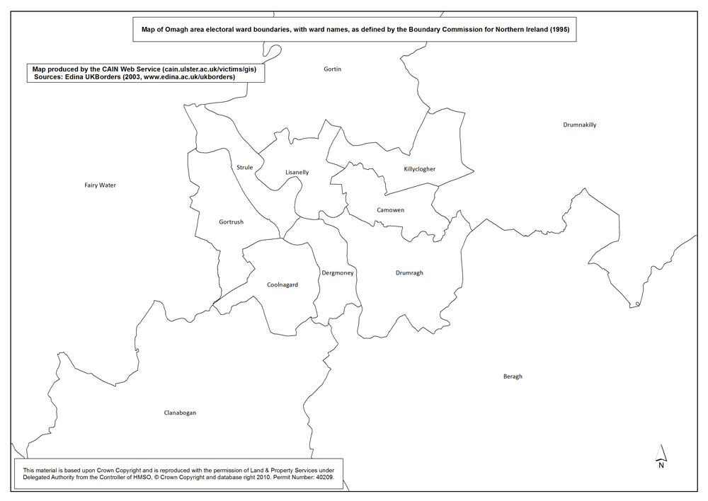
- Map D. Omagh area;
- Map E. Dungannon area;
- Map F. Armagh area;
- Map G. Craigavon area.
| Maps: Outline Maps, by area, of Ward Boundaries (1995) (8 maps compiled and drawn by Luke Kelleher) |
| Title of Map |
File Version |
| PDF |
L-JPG |
H-JPG |
| Belfast |
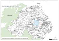
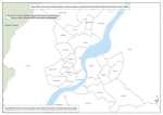
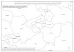
 Ward Boundaries - Northern Ireland Ward Boundaries - Northern Ireland
Map of Northern Ireland electoral ward boundaries, with ward names, as defined by the Boundary Commission for Northern Ireland (1995). |
.pdf
818kb |
.jpg
208kb |
.jpg
1673kb |
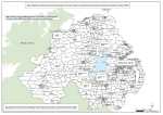
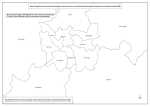
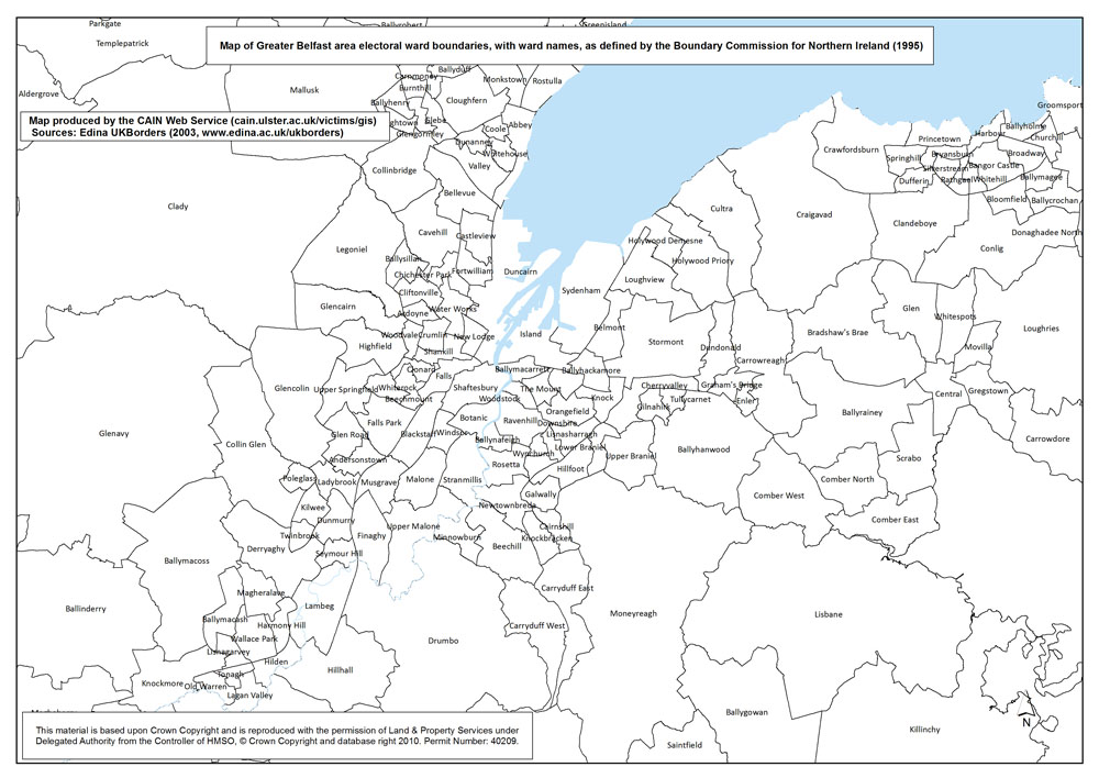
 Ward Boundaries - Belfast Ward Boundaries - Belfast
Map A. Map of Greater Belfast area electoral ward boundaries, with ward names, as defined by the Boundary Commission for Northern Ireland (1995). |
.pdf
674kb |
.jpg
189kb |
.jpg
1336kb |
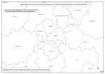
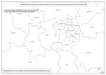 Ward Boundaries - Ballymena Ward Boundaries - Ballymena
Map B. Map of Ballymena area electoral ward boundaries, with ward names, as defined by the Boundary Commission for Northern Ireland (1995). |
.pdf
387kb |
.jpg
108kb |
.jpg
719kb |
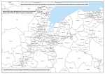
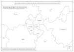
 Ward Boundaries - Derry Ward Boundaries - Derry
Map C. Map of Derry area electoral ward boundaries, with ward names, as defined by the Boundary Commission for Northern Ireland (1995). |
.pdf
381kb |
.jpg
109kb |
.jpg
717kb |
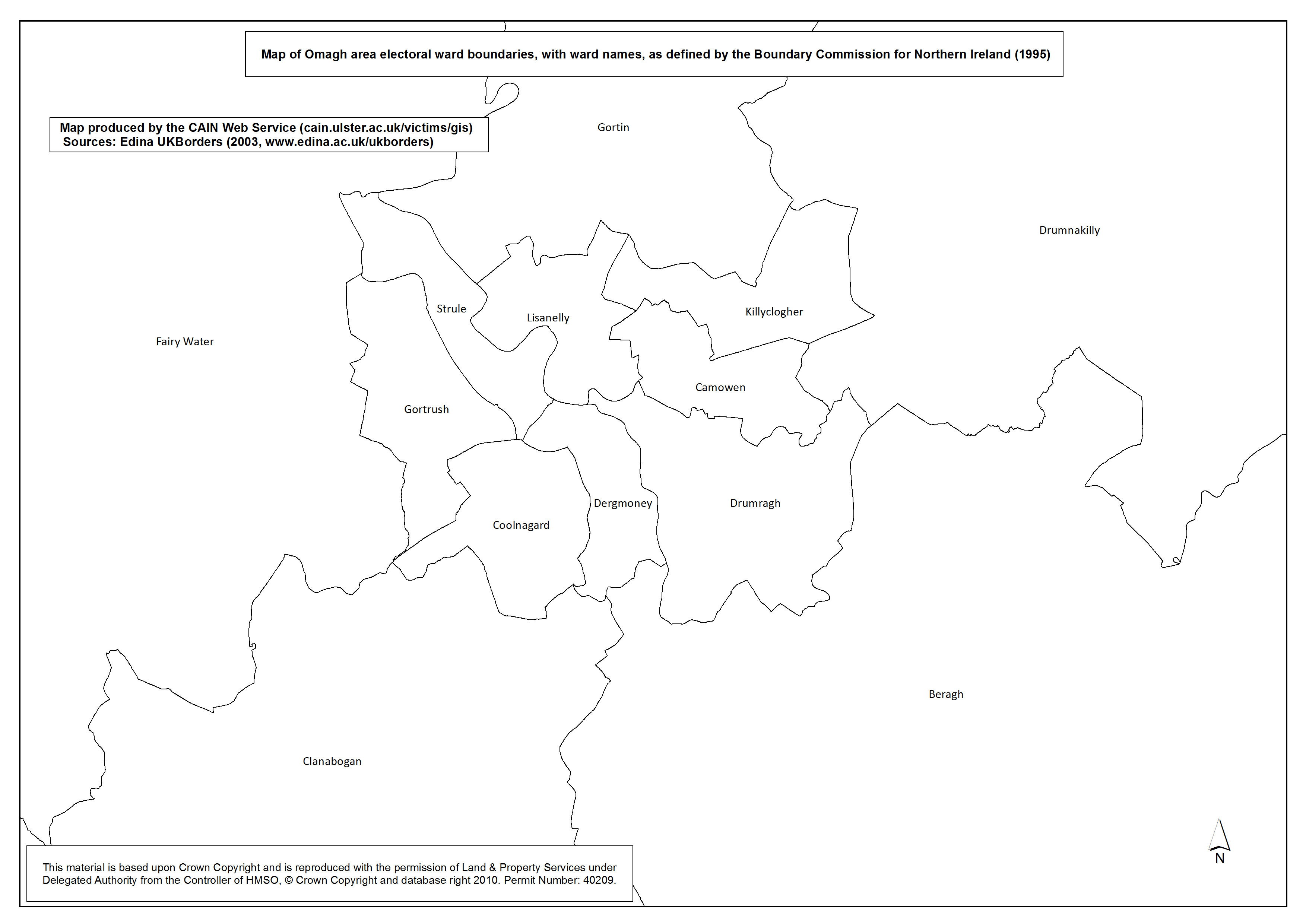
 Ward Boundaries - Omagh Ward Boundaries - Omagh
Map D. Map of Omagh area electoral ward boundaries, with ward names, as defined by the Boundary Commission for Northern Ireland (1995). |
.pdf
343kb |
.jpg
94kb |
.jpg
634kb |
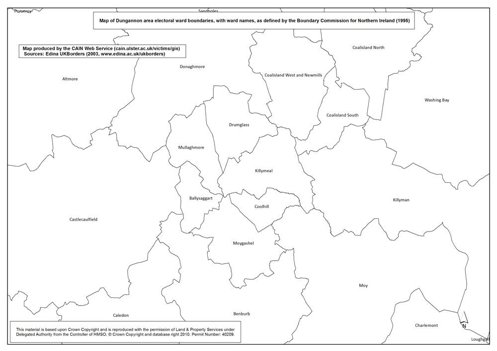
 Ward Boundaries - Dungannon Ward Boundaries - Dungannon
Map E. Map of Dungannon area electoral ward boundaries, with ward names, as defined by the Boundary Commission for Northern Ireland (1995). |
.pdf
387kb |
.jpg
108kb |
.jpg
721kb |
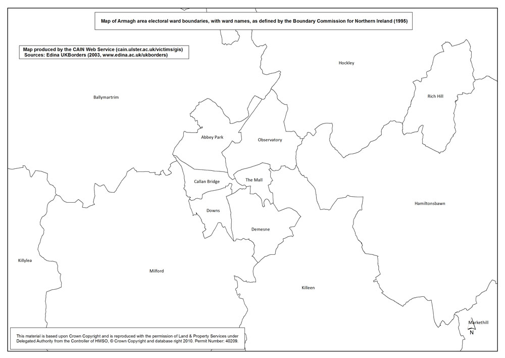
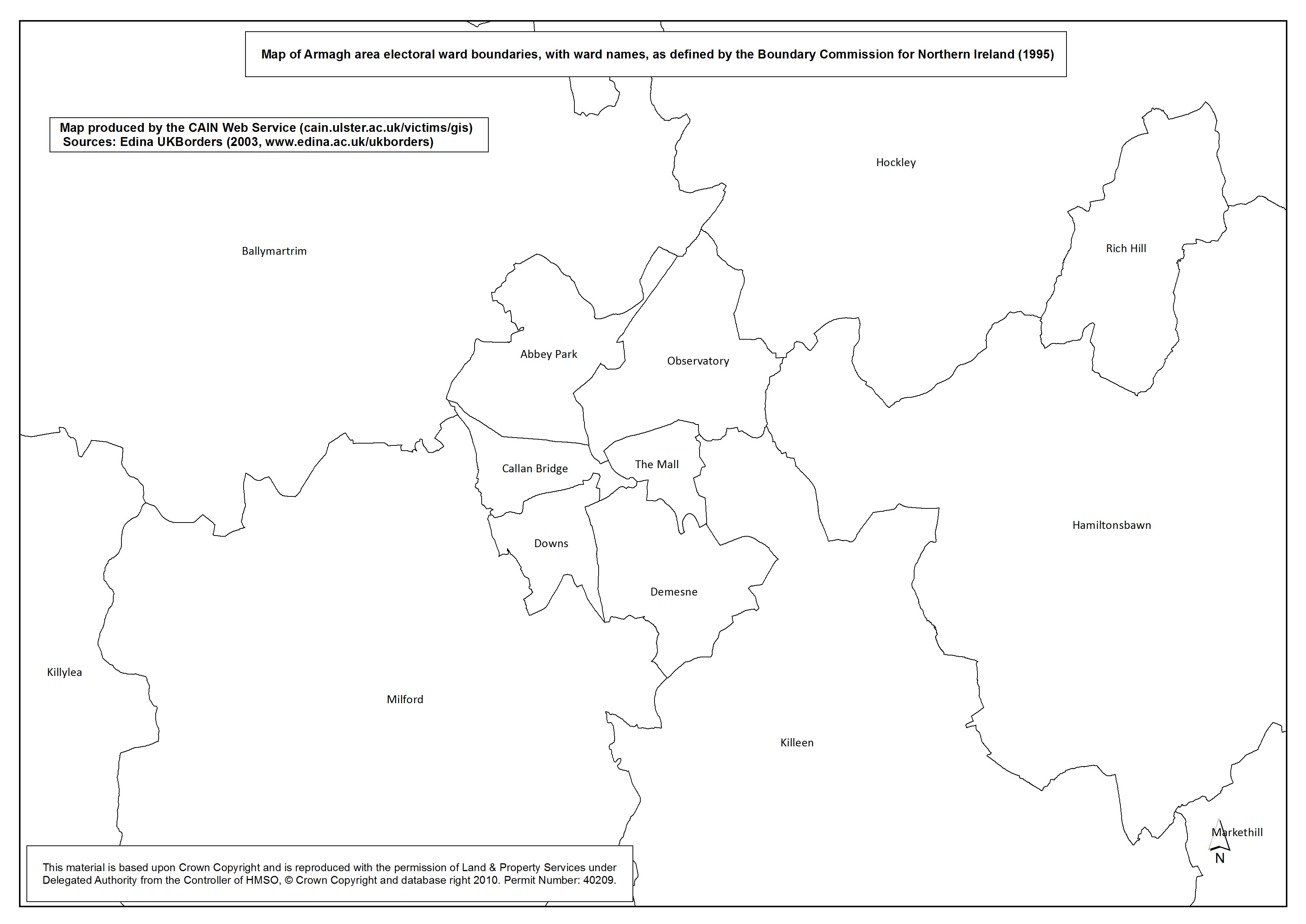
 Ward Boundaries - Armagh Ward Boundaries - Armagh
Map F. Map of Armagh area electoral ward boundaries, with ward names, as defined by the Boundary Commission for Northern Ireland (1995). |
.pdf
348kb |
.jpg
96kb |
.jpg
644kb |
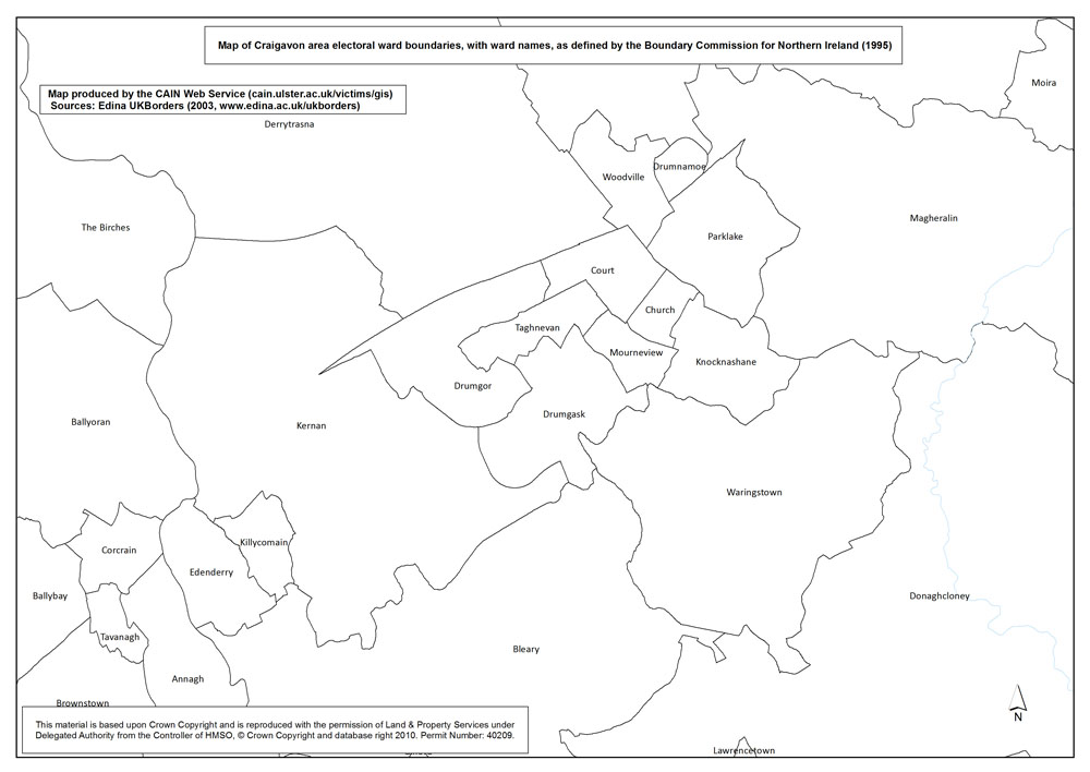
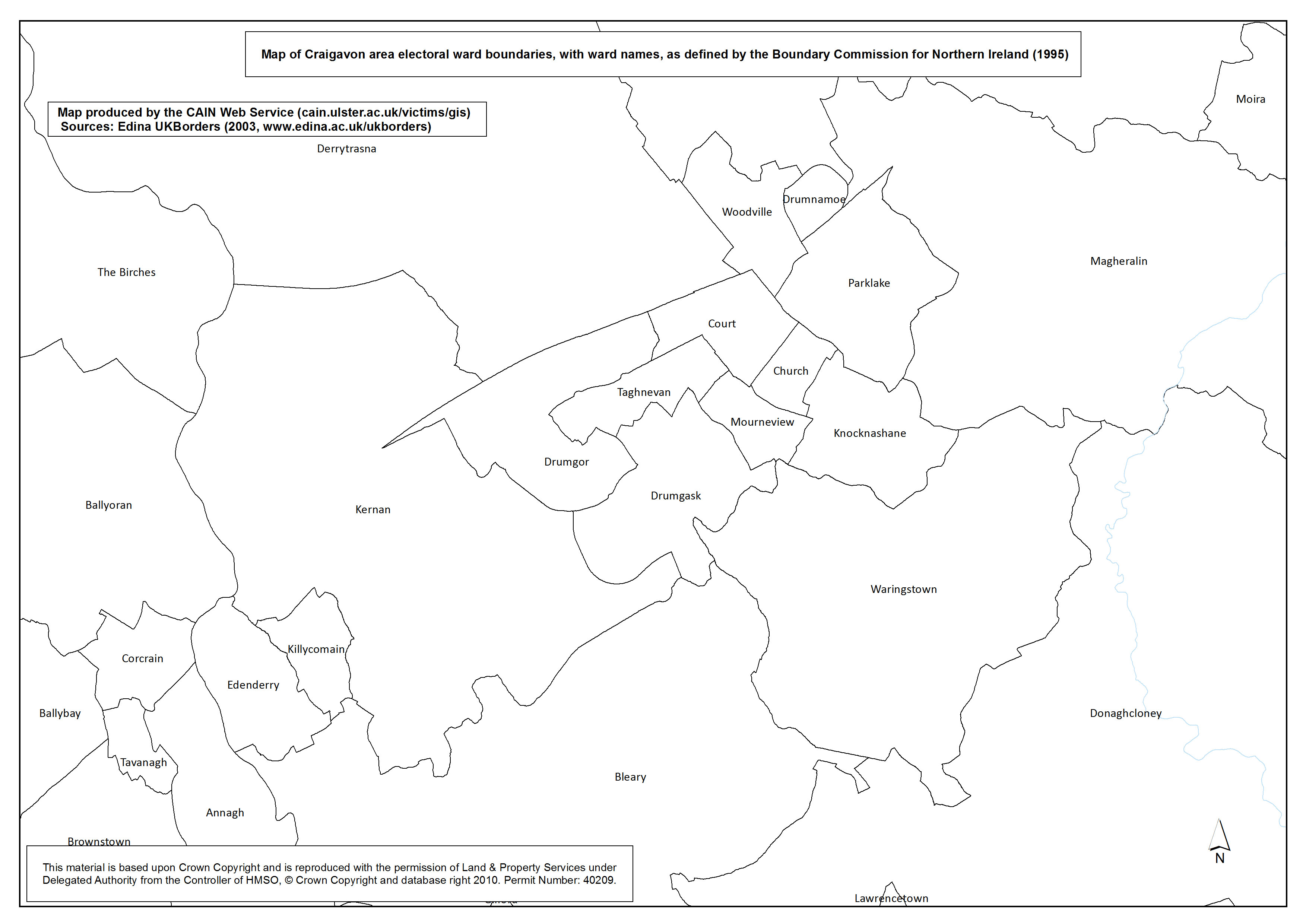
 Ward Boundaries - Craigavon Ward Boundaries - Craigavon
Map G. Map of Craigavon area electoral ward boundaries, with ward names, as defined by the Boundary Commission for Northern Ireland (1995). |
.pdf
403kb |
.jpg
114kb |
.jpg
753kb |
| Outline Maps: Commentary - Martin Melaugh |
These maps are provided as background information. Due to the small size of many of the urban wards it is not possible to read their names on a map drawn to the scale of Northern Ireland. These maps may therefore be of use to researchers who are viewing other map sets which provide results (say, deaths) at ward level. Even researchers based in Northern Ireland are unlikely to be familiar with the precise boundaries and names of many of the 582 wards.
The electoral ward shapefile was obtained from EDINA borders Web site:
http://borders.edina.ac.uk/html/lut_download/ni_ward.html
The GIS maps listed above have been produced as part of the AHRC 'Visualising the Conflict' Project. The maps have been reproduced and made available with the permission of Land & Property Services under Delegated Authority from the Controller of HMSO, © Crown Copyright and database right 2010; Permit Number: 40209.
All maps were prepared by Luke Kelleher, then a Research Associate (GIS) working with CAIN. All maps were sized A4 (approximately). GIS software was used to produce TIFF versions (A4 approx; 300dpi) which are available on request. Three versions of each map have been made available above:
- PDF versions (A4 approx; 300dpi) are based on original TIFF files.
- L-JPG versions (1000px700p approx; 72dpi) are low resolution JPEG images.
- H-JPG versions (A4 approx; 300dpi) are high resolution JPEG images.
Return to List of Map Sets
|
