Visualising the Conflict
Geographic Information Systems (GIS) Maps
Map Set 10:
Child Deaths |
| Map Set 10: Child Deaths - Introduction |
Child victims of the conflict, Belfast, Derry and Northern Ireland
3 maps
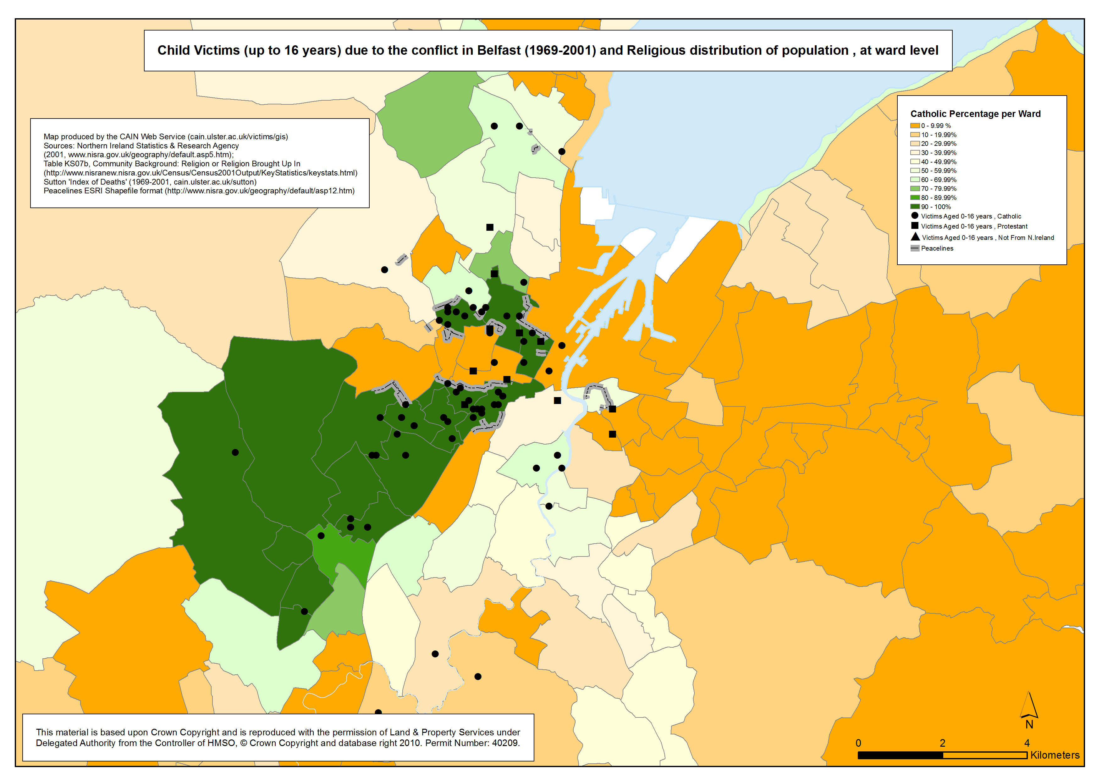
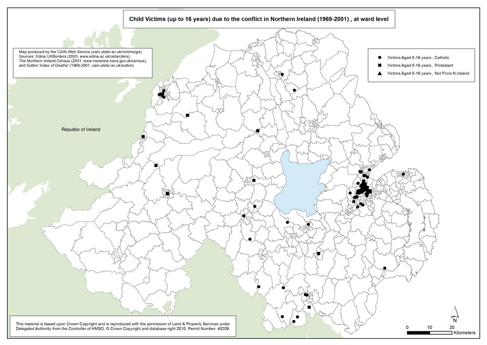
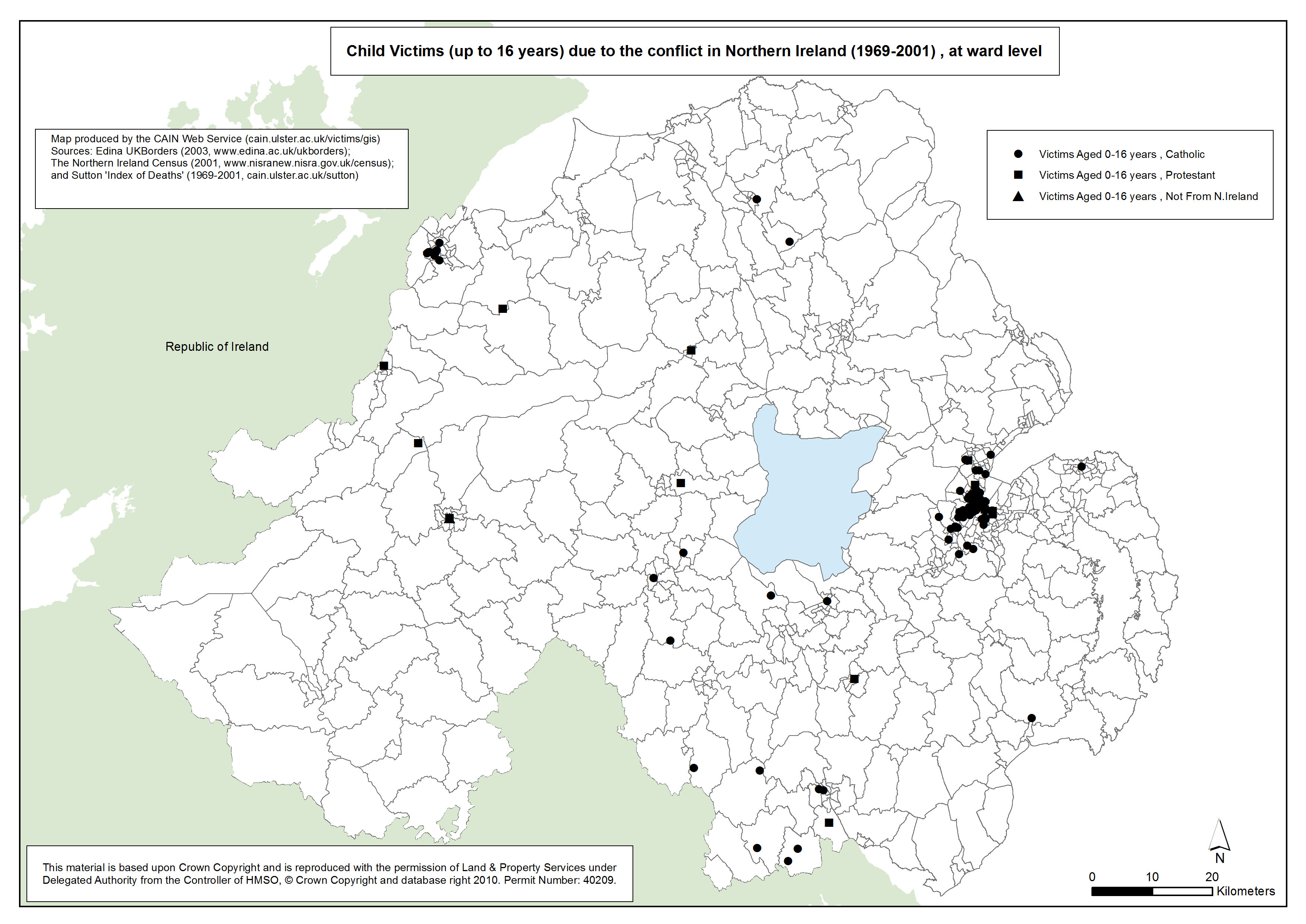
 This set of map plots the location of deaths due to the conflict of child victims (0-16 year olds)in Northern Ireland . The information used to name, locate and plot each victim is provided by Malcolm Sutton’s “Index of Deaths 1969-2001”. (http://www.cain.ulster.ac.uk/sutton/). This set of map plots the location of deaths due to the conflict of child victims (0-16 year olds)in Northern Ireland . The information used to name, locate and plot each victim is provided by Malcolm Sutton’s “Index of Deaths 1969-2001”. (http://www.cain.ulster.ac.uk/sutton/).
Data is mapped at electoral ward level and is based on the 2001 Northern Ireland Census survey results. There are 582 electoral wards in Northern Ireland as defined by the Boundary Commission for Northern Ireland in 1995. The electoral ward shapefile was downloaded from EDINA borders website. (http://borders.edina.ac.uk/html/lut_download/ni_ward.html).
| Maps - Locations of deaths of child victims of the conflict, Belfast, Derry and Northern Ireland (3 maps compiled and drawn by Luke Kelleher) |
| Title of Map |
File Version |
| PDF
| L-JPG
| H-JPG
|
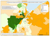
Child deaths - Belfast
Location of child deaths (up to 16 years) due to the conflict in Belfast, and Religious distribution of population, at ward level. |
.pdf
467kb |
.jpg
137kb |
.jpg
1078kb |
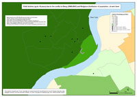 Child deaths - Derry Child deaths - Derry
Location of child deaths (up to 16 years) due to the conflict in Derry, and Religious distribution of population, at ward level. |
.pdf
364kb |
.jpg
84kb |
.jpg
773kb |
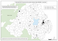 Child deaths - Northern Ireland Child deaths - Northern Ireland
Location of child deaths (up to 16 years) due to the conflict in Northern Ireland, and Religious distribution of population, at ward level. |
.pdf
568kb |
.jpg
136kb |
.jpg
1082kb |
|
