Visualising the Conflict
Geographic Information Systems (GIS) Maps
Map Set 23:
Physical Memorials
Maps drawn by Luke Kelleher; text by Martin Melaugh |
| Map Set 23: Physical Memorials - Introduction |
Maps - Physical memorials related to the conflict, in Belfast, Derry, and Northern Ireland (7 maps)
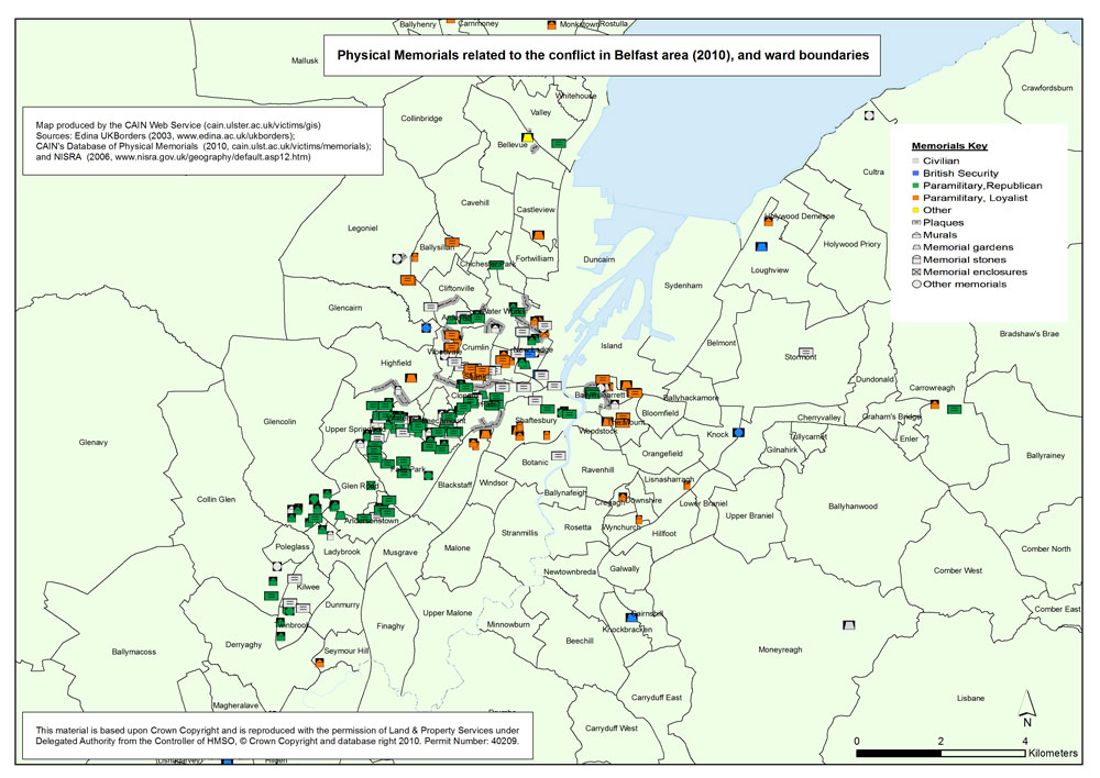
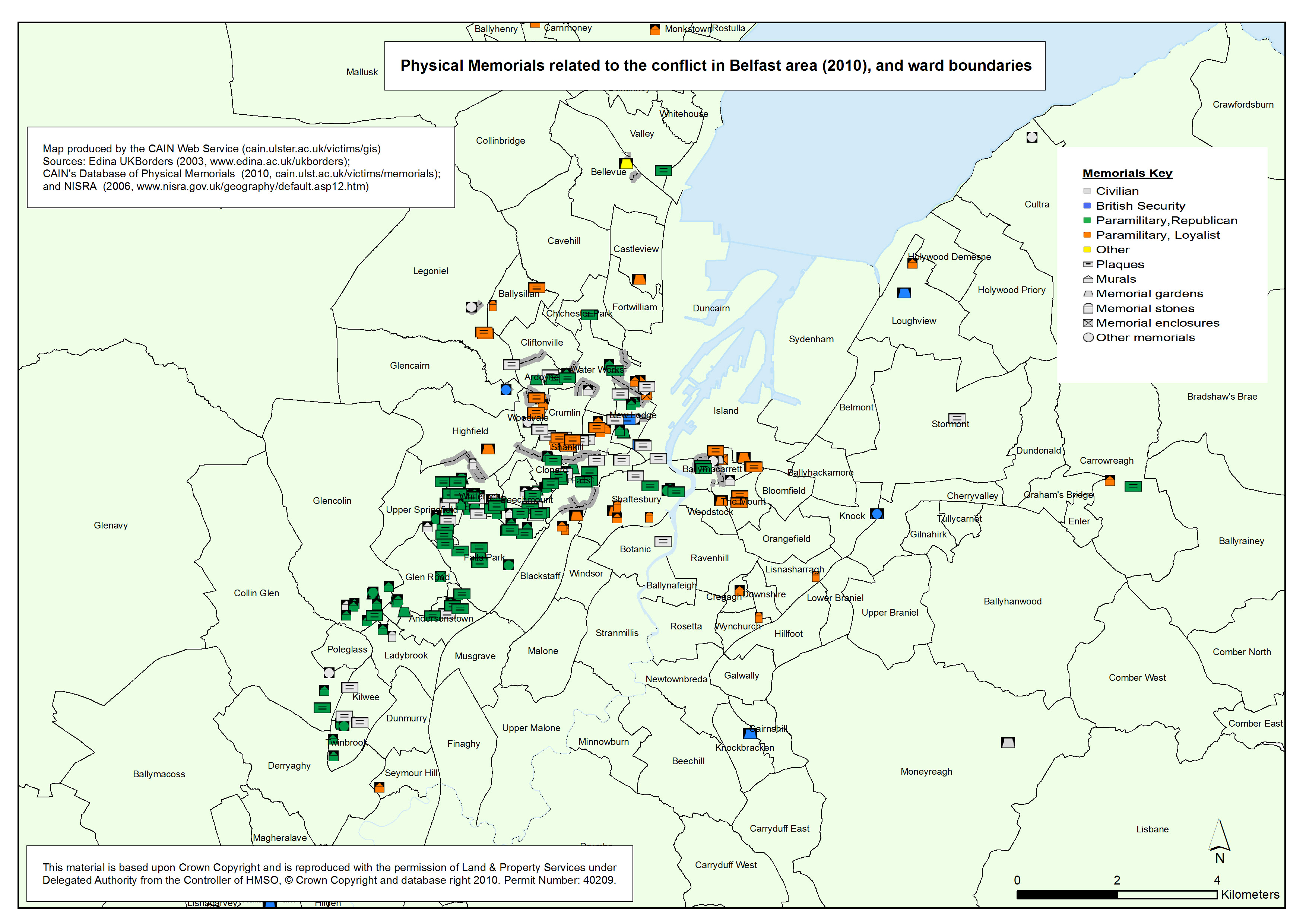
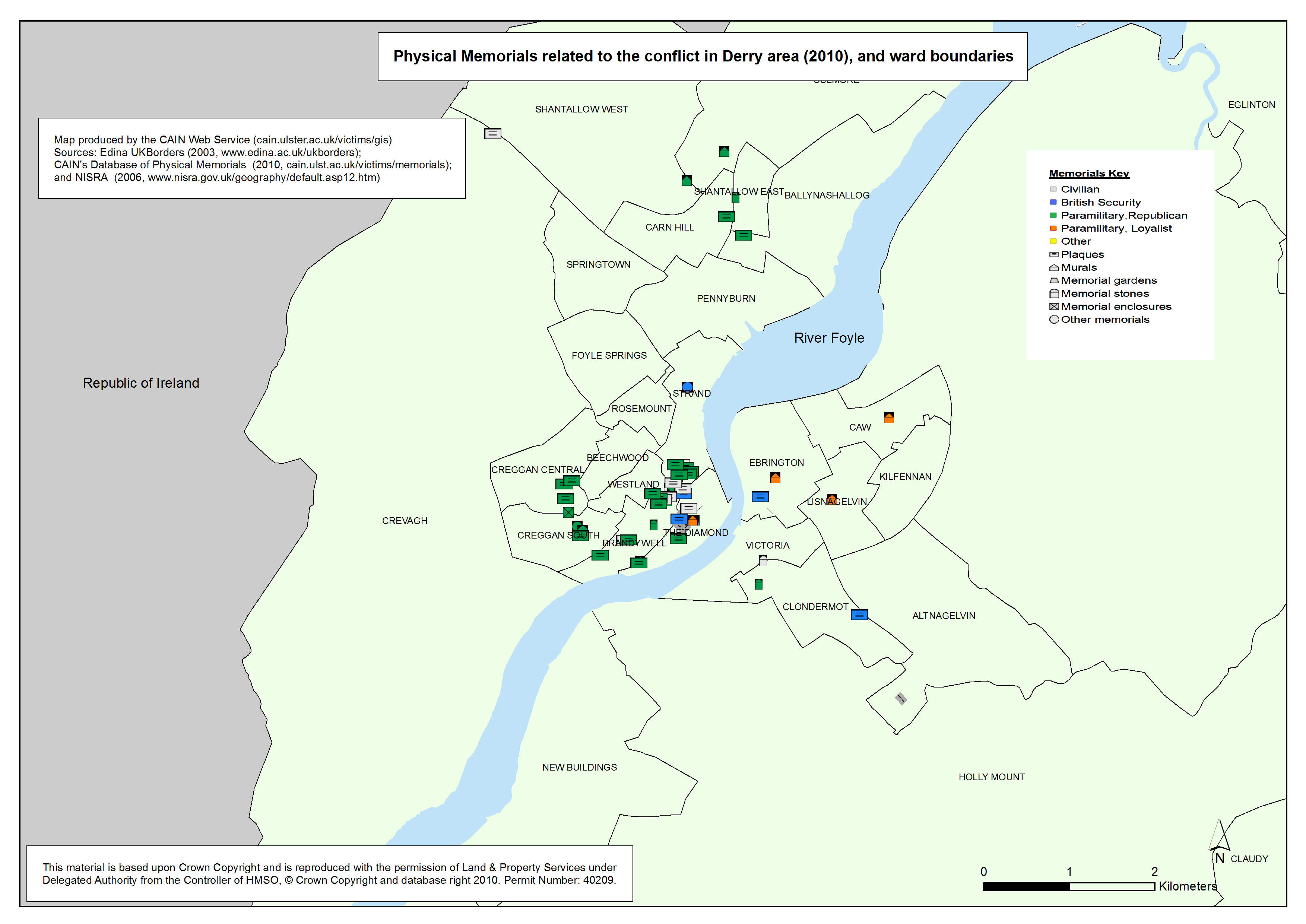
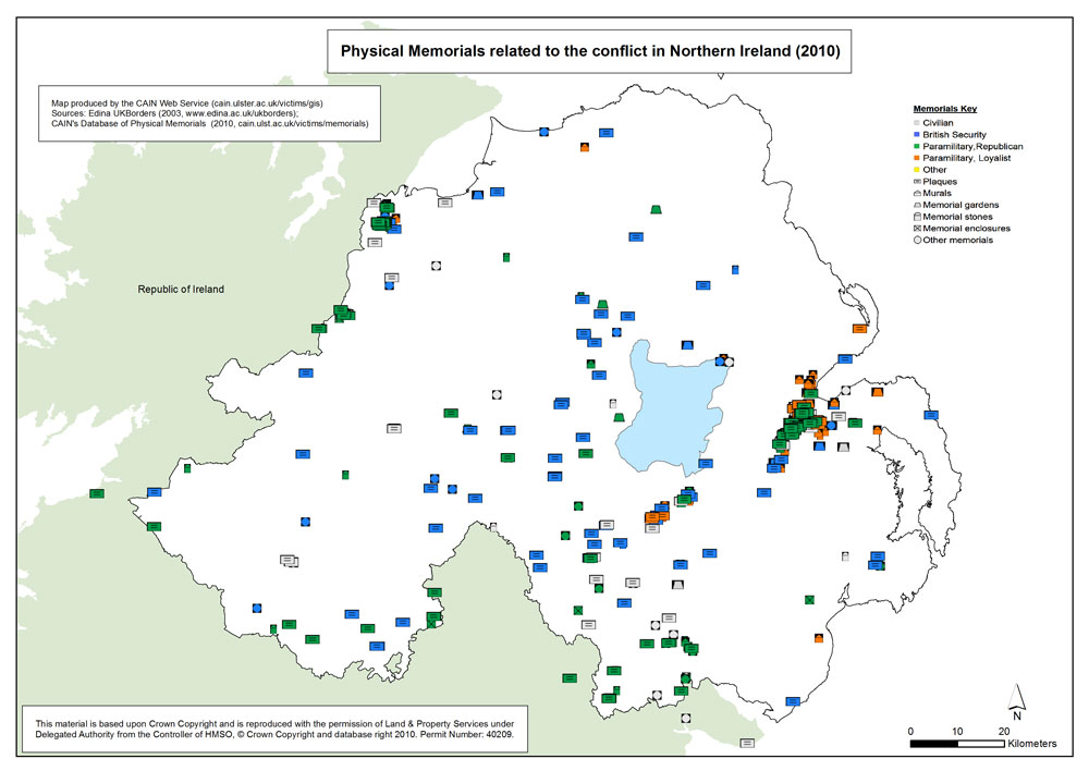
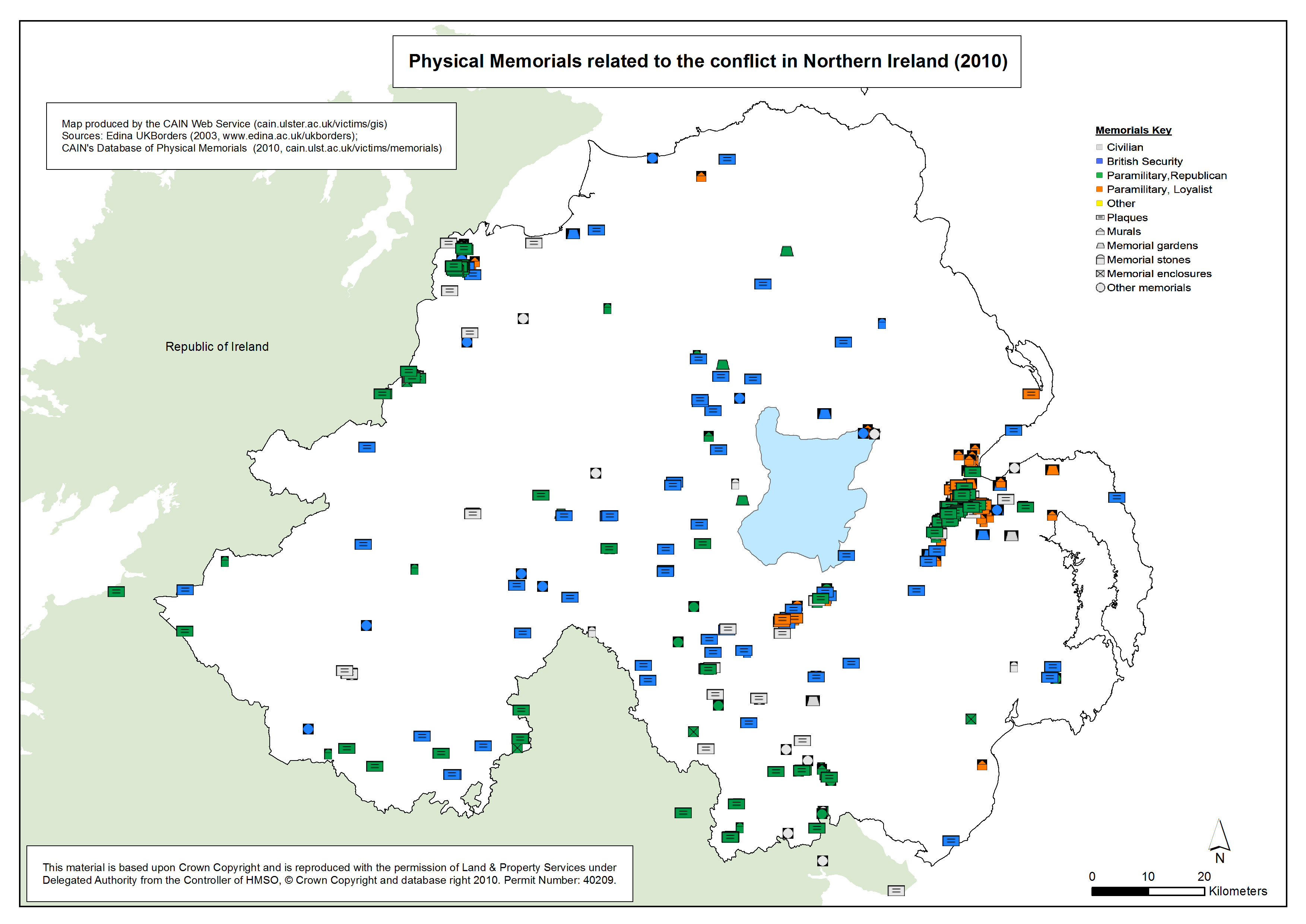
 Using the latitude and longitude co-ordinates recorded in the CAIN database of memorials, it was possible to plot the locations of the memorials. The information used to locate and plot each memorial is provided by CAIN’s Database of Physical Memorials to the conflict in Northern Ireland Using the latitude and longitude co-ordinates recorded in the CAIN database of memorials, it was possible to plot the locations of the memorials. The information used to locate and plot each memorial is provided by CAIN’s Database of Physical Memorials to the conflict in Northern Ireland
(http://cain.ulster.ac.uk/victims/memorials/search.html)
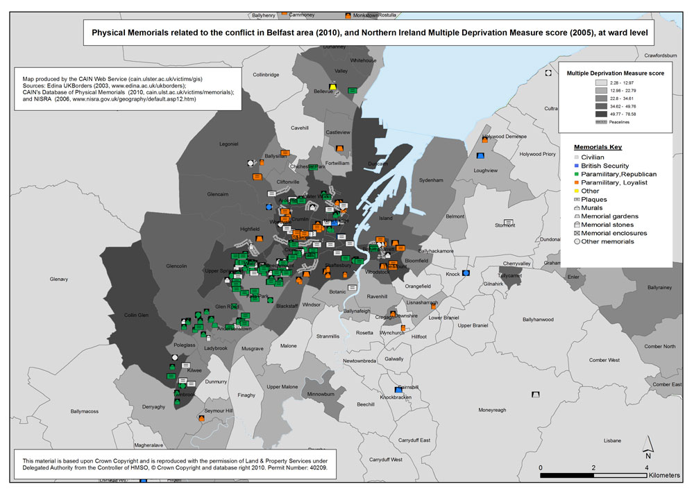
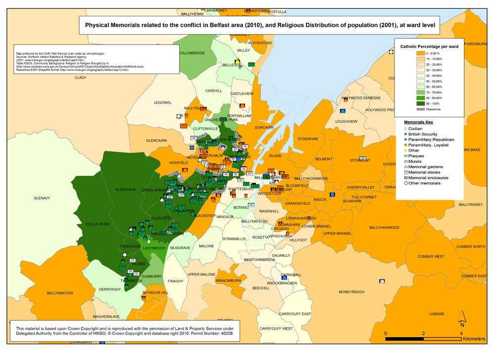
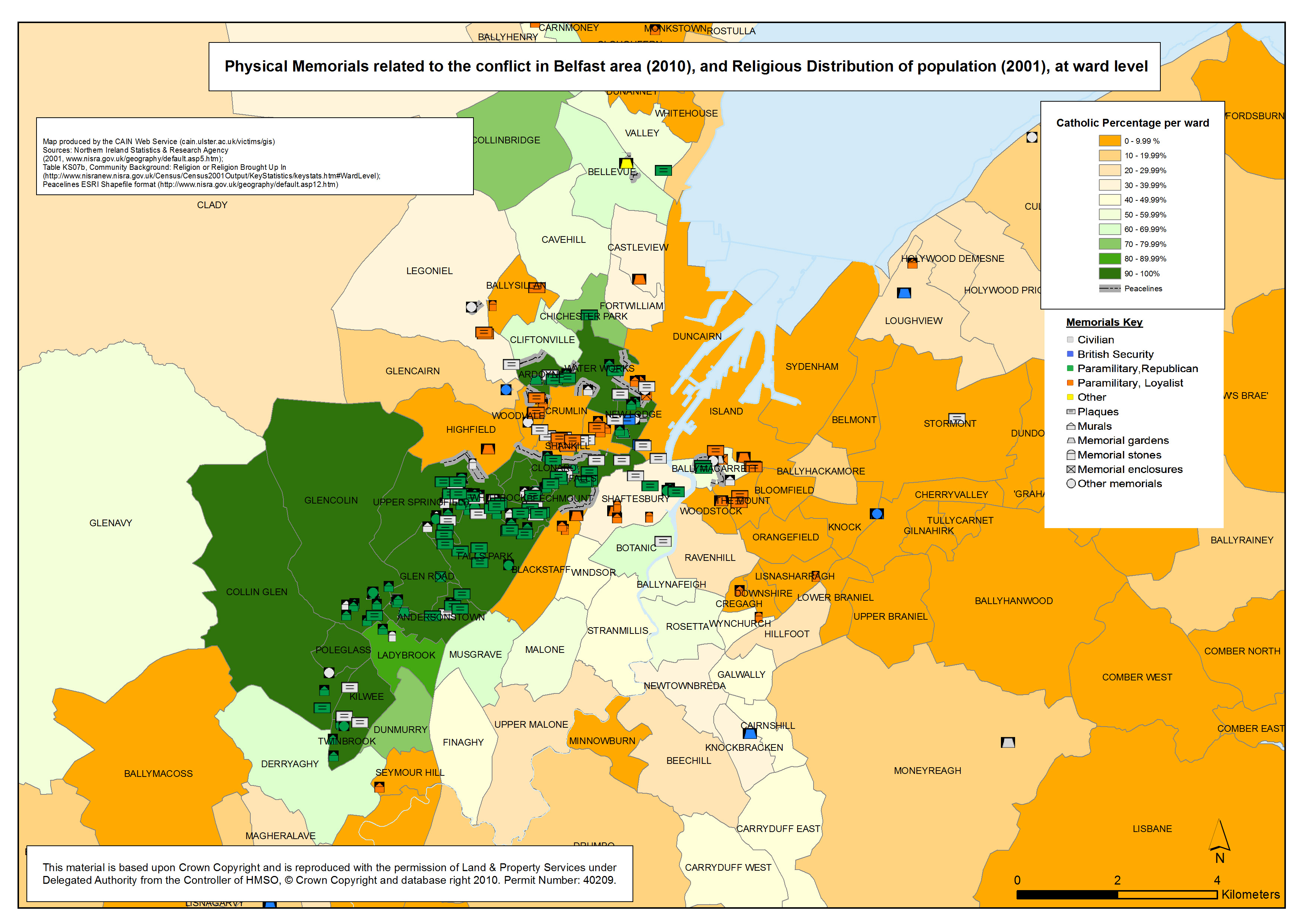
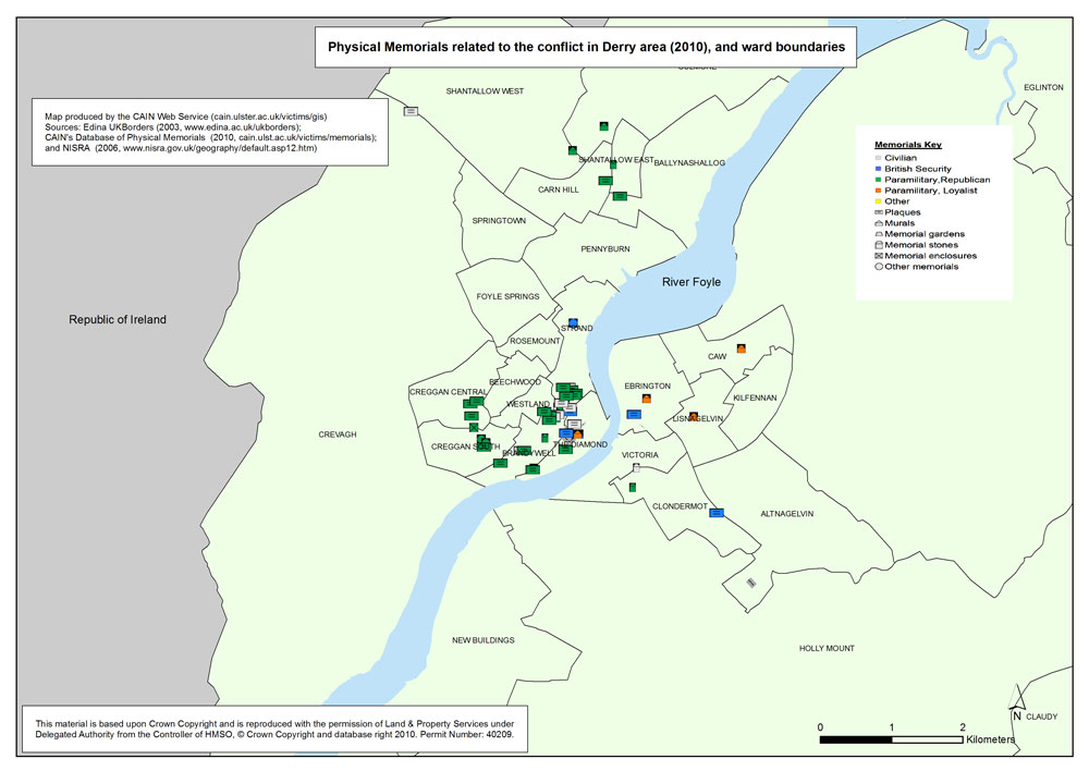
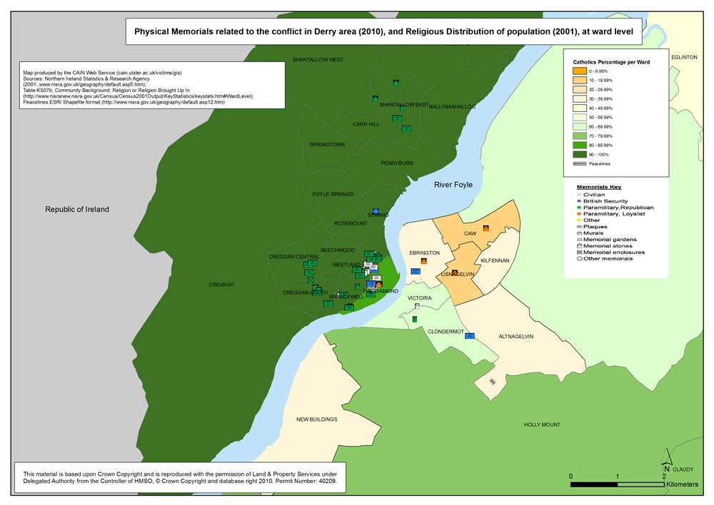
The memorials were classified by both Nature (Civilian; British Security; Republican Paramilitary; Loyalist Paramilitary; and Other) and Physical Type (Plaques; Murals; Memorial Gardens; Memorial Stones; Memorial Enclosures; and Other Memorials).
This set of maps, also illustrates the distribution of the Catholic population. Data is mapped at electoral ward level and is based on the 2001 Northern Ireland Census survey results. The religious background data was downloaded from the Northern Ireland Statistics and Research Agency
(http://www.nisranew.nisra.gov.uk/census/Census2001Output/
KeyStatistics/ks_settlements.html#settlement%20%20tables)
The table used was titled Table 7S07b Community Background: Religion or Religion Brought Up In
The electoral ward shapefile was downloaded from EDINA borders website. (http://borders.edina.ac.uk/html/lut_download/ni_ward.html)
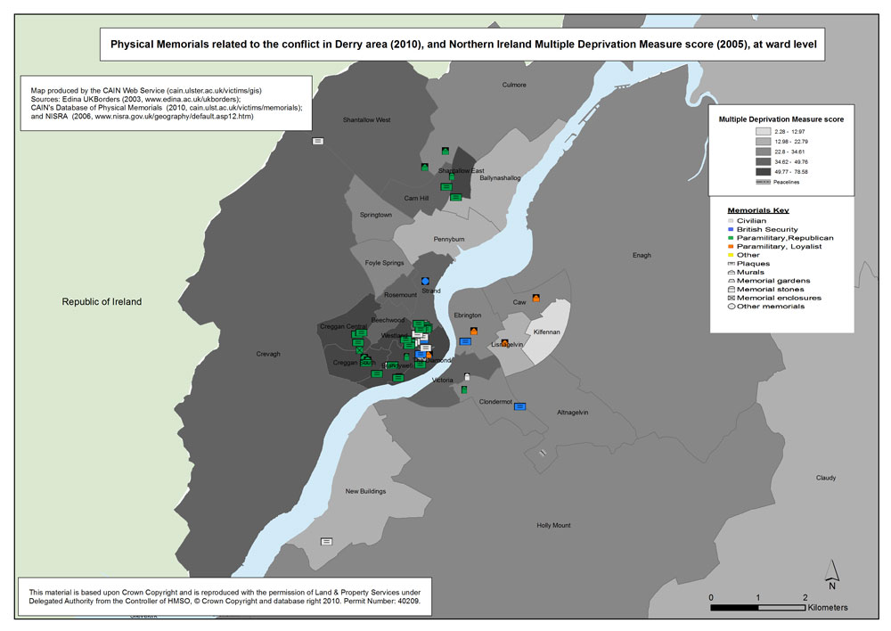
The Northern Ireland Multiple Deprivation Measure (NIMDM) 2005 score for each ward is also mapped. The NIMDM is a combination of seven types or 'domains' of deprivation:
- Income Deprivation 25%
- Employment Deprivation 25%
- Health Deprivation and Disability 15%
- Education, Skills and Training Deprivation 15%
- Proximity to Services 10%
- Living Environment 5%
- Crime and Disorder 5%
The NIMDM was downloaded from the Northern Ireland Statistics and Research Agency
(http://www.ninis.nisra.gov.uk/mapxtreme_deprivation2005/datacatalogue.asp?button=ward)
| Maps - Physical memorials related to the conflict, in Belfast, Derry, and Northern Ireland (7 maps compiled and drawn by Luke Kelleher) |
| Title of Map |
File Version |
| PDF
| L-JPG
| H-JPG
|
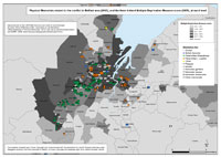
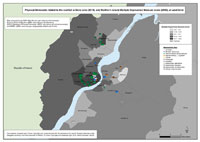
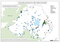
 Memorials - Belfast Memorials - Belfast
Physical memorials related to the conflict in Belfast area (2010), and wards boundaries (2001). |
.pdf
632kb |
.jpg
155kb |
.jpg
1465kb |
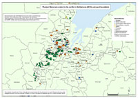
Memorials - Deprivation (MDM) - Belfast
Physical memorials related to the conflict in Belfast area (2010), with Multiple Deprivation Measure score, at ward level (2001). |
.pdf
517kb |
.jpg
131kb |
.jpg
1263kb |
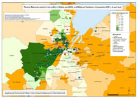 Memorials - Religion - Belfast Memorials - Religion - Belfast
Physical memorials related to the conflict in Belfast area (2010), with the distribution of Catholics, at ward level (2001). |
.pdf
583kb |
.jpg
169kb |
.jpg
1618kb |
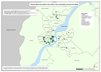 Memorials - Derry Memorials - Derry
Physical memorials related to the conflict in Derry area (2010), and wards boundaries (2001). |
.pdf
427kb |
.jpg
96kb |
.jpg
958kb |
 Memorials - Deprivation (MDM) - Derry Memorials - Deprivation (MDM) - Derry
Physical memorials related to the conflict in Derry area (2010), with Multiple Deprivation Measure score, at ward level (2001). |
.pdf
380kb |
.jpg
85kb |
.jpg
873kb |
 Memorials - Religion - Derry Memorials - Religion - Derry
Physical memorials related to the conflict in Derry area (2010), with the distribution of Catholics, at ward level (2001). |
.pdf
418kb |
.jpg
100kb |
.jpg
1015kb |
 Memorials - NI Memorials - NI
Physical memorials related to the conflict in Northern Ireland (2010). |
.pdf
410kb |
.jpg
96kb |
.jpg
873kb |
|
